The Haute Route Pyrenees (HRP)
Firstly, I had no plan to do the HRP; I had half an idea to have a backpacking trip to the Pyrenees in 2014 but no real plan of what or where. Out of the blue I spotted a posting on the Outdoors Magic forum “Anyone interested in joining me/ us for all or part of the Pyrenees coast-to-coast…HRP…GR10…GR11”, well after some quick research it seemed too good an opportunity to miss so I dived in. It turned out I would be travelling with a couple of companions Mike & Isobel both experienced backpackers.
Planning
In comparison to some of my backpacking trips I did very limited planning, no day to day itinerary (like the TGO Challenge), my ‘plan’ was simply to walk and see where I ended up picking up supplies where I could. While travelling nominally together were prepared to travel independently, in case of differing paces etc, so there wasn’t a real opportunity to cut the base weight by sharing stuff.
I bought a copy of the Cicerone HRP Guide which I scanned to produce a very abridged Word version, I got the content down to 23 double sided A4 this saved a lot of weight 150g (including an Aloksak) Vs 390g for the guide, I did have a full copy on my iPhone but never used it.
Maps for the French side were obtained from Routebuddy IGN 50k Region 7, £40, can’t say I was impressed by the quality but it was adequate to produce A4 ‘day’ maps.
Maps for the Spanish/ Andorra side were a little more prioblematic; I eventually downloaded a series of maps from Centro de Descargas. The site has both the 50k & 25k maps covering all of Spain& Andora which can be downloaded for free in TIFF format and then be cropped, printed etc. Some of the maps were a little out of date but again they proved adequate. The 23 double sided A4 ‘day’ maps produced ended up weighed a lot less than carrying the full size maps, 150g (including Aloksak) Vs a lot? The A4 maps & the abridged guide ended up weighing less than the Cicerone guidebook.
Mike & I did some trawling of the internet for further information particularly on the potential resupply points since it was evident that these are problematic unless diversions are planned. One failing of the guide is the complete absence of any information on the availability of fuel; as a general observation I found the screw top gas is hard to come by, meths (Alcool Bruler = burning alcohol) proved widely available.
Getting to the start:
I flew in to Biarritz (Ryanair) from Stansted, the biggest pain was the horrendous queues at security.
At Biarritz we took the local bus to Hendaye the #816 (LINK) pretty cheap €2 for over an hour’s ride. The bus leaves from just outside the arrivals hall and drops at ‘Hendaye Ville’ which is about 20 mins walk from the start of the HRP at the Residence Croisiere.
In this post I’ve tried to not to get into a route description but generally tried to include factual information that others may find useful in their planning; locations are generally referenced to the Cicerone Guide but I’ve used the term Stage to mean guidebook ‘day’, together with the appropriate time e.g. [Stage 20, 1:30] = Guidebook day 20 & 1 hr 30mins.
Day 1 -Wednesday, 09 July 2014
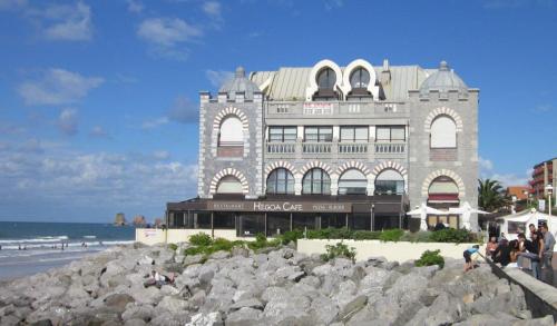
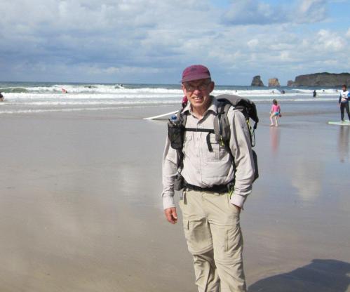
We’d arrived fairly late ~5pm but rather than staying overnight at the campsite we decided to walk out of town & wild camp somewhere. Firstly we had to complete the ritual toe wetting on the beach.
Having packed a 3 days rations we only had to pick up Alcool from the well stocked supermarket 50m east of the start & it was off.
A short 3hr stroll but a good way of stretching the legs after the journey. Camped at Col des Poiriers (~ GPS: 604000/ 4796850), [Stage 1, 3:30], pitch was quite good with water from a small stream in the woods ~150m away.
Day 2 – Thursday, 10 July 2014
The shop in Col d’Ibardin didn’t seem to be open when we passed through but we didn’t need anything so didn’t check it out.
I got separated from Mike & Isobel having taken a wrong turn while they were a few hundred metres ahead & then got ‘lost’ again coming down off La Rhune; as it says in the guide “Pay attention, because the junction can easily be missed”, I obviously wasn’t & ended up bushwhacking through gorse for nearly an hour.
I eventual caught up with the others when they pulled up for the night by ruined farmhouse (GPS: 620151/ 4783559), [Stage 2, ~6:00], pitch was good but no water, had to bushwhack nearly 1km downhill to a stream through thick gorse (again!) to get some.
Day 3 – Friday, 11 July 2014
The small shop in Arizkun [Stage 2, End] was very poorly stocked, more Tabac than food, no fuel (alcool); there was another shop selling meat & cheese across the street which was more useful.
The garage shop in Les Aldudes was closed when we arrived (seemed the ‘norm’ for all the shops on route to closed 12:30 to 3:00pm & after lunch on Sundays) so we enjoyed a good lunch in the Bar Alfaro just down the street while we waited. The shop proved very well stocked (including alcool) one of the best on the HRP.
Camped by roadside at Col de Burdincurutch (GPS: 633184/ 4765511), [Stage 4, ~4:00], we’d picked up water back at Col d’ Hauzay.
Day 4 – Saturday, 12 July 2014
A day of wandering the hills in rain & low cloud.
Camped at Egurgui (GPS: 651224/ 4765166), [Stage 5, End], definitely the worst pitch on the trip, a quagmire. The whole valley had been churned up by 100’s of cattle & s**t everywhere! No sign of the “fine & quiet places for a bivouac” mentioned in the guide.
Day 5 – Sunday, 13 July 2014
A steep ascent up to Col Curutche (1285m) started the day (we all agreed we should have grabbed water in the valley & headed up here for the night, lot’s of splendid placed to pitch), followed by a pleasant stroll across the Plateau d’Occabe; no navigation issue (“even under normal conditions route finding is not easy”) other than the odd confusion caused by the guidebook wording.
Lunched at Chalet Pedro; quality good, quantity lacking & I thought it a bit expensive; there’s another restaurant 400m up the valley on the left that looked more promising and there was also camping nearby.
Mike decided to bailed out here after suffering from bad blisters (he later blamed a defect in his Salomon trail shoes) which took a few weeks to recover from, he luckily managed to hitch a ride all the way back to Biarritz airport within a very short time.
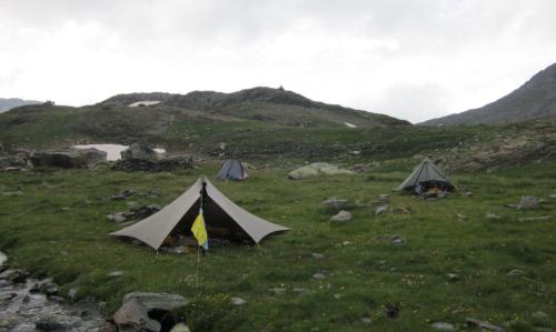
Camped above Col Mehatze by cattle trough (~GPS: 6600200/ 4766000), [Stage 7, ~1:00], good pitch & water, but cattle did disturb the evening.
Day 6 – Monday, 14 July 2014
The description in the guide for the first couple of hours of Stage 7, Col Mehatze to Col de Tharta quite obtuse and some of the wording is quite misleading. “Don’t go all the way to the hut but leave the dirt road to your left” is actual a turn right as the dirt road turns left; “follow an almost level path” actually has quite a bit of up & down across the NE flank of a ridge gradually climbing to the col, in clear weather it’ll be straightforward but in the mist it was a little confusing.
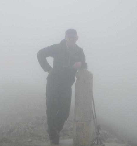
Pic de Orhy (2017m) our first +2000m peak was reached, no gob smacking view just the Basque mist.
Camped in the forest ~1.5km east of Refugio de Belagua (~GPS: 678294/ 4757121), [Stage 8, ~5:30], not a bad pitch, picked up water near the Refugio.
Day 7 – Tuesday, 15 July 2014
The morning brought ‘real’ mountains; we past the Source de Marmitou, with the weather much improved, the area is probably one of the nicest places to pitch up on the HRP but it was way too early & Lescun was too close to stop.
Camped at the site on the edge of Lescun [Stage 9, End]. The small supermarket was well stocked & had alcool. Had a late lunch at the bar/ restaurant which was good and reasonably priced.
Day 8 – Wednesday, 16 July 2014
Left Lescon late after having to go back to the shop for the stuff we’d inadvertently left behind. A really pleasant day’s walking with the ‘big’ stuff getting closer.
Camped near the footbridge in Pla d’Espelunguere (GPS 697586/ 4742534) [Stage 12, ~3:00]
Day 9 – Thursday, 17 July 2014
Small shop in Astun noted in guide wasn’t open. Lunched at the “Yeti” bar/ restaurant, a good 2 course meal for €11, one of the best on the trip.
There was lots of tourist using the ski lift to head up the mountain for a day out & it was quite tempting after a big lunch rather than the ~500m climb. Ibon de Escalar seemed like a popular place for a picnic & there were ample places to pitch up.
Camped at Refuge Pombie [Stage 12, End], not a lot of level pitches available, did enjoy the mug of vin rouge.
Day 10 – Friday, 18 July 2014
Passage d’Orteig proved easy but not one for vertigo sufferers.
Lots of hard snow still around in the Col du Palas (2517m) & Port du Lavedan (2615m) making for slow going, the microspikes came in very handy.
Camped in the valley at Cabane de Doumblas (1560m, 723265/ 4749937) [Stage 14, 1:15]
Day 11 – Saturday, 19 July 2014
With the amount of snow still around we made the decision to avoid the Col de Cambales (2706m) [Stage 14, 15:15] and head down SE from Port de la Peyre-St-Martin (2295m) to pick up the GR11 by Embalse de Respomuso and then head over the Col de la Fache (2664m) back to rejoin the main route at Refuge Wallon.
Lots of snow on Col de la Fache but it wasn’t steep enough to be an issue.
Lunched Refuge Wallon & probably had the best ‘trail’ lunch on the trip; a big plate of chorizo, beans & potatoes, proper trail food. Lots of great bivouac sites above & below the refuge.
The afternoon sky looked very threatening as we headed towards Col d’Arratilie (2528m)
So we pulled up & camped at Lac d’Arretille (2270m, 730932/ 4742722) [Stage 15, 1:35]; it didn’t take long for the thunderstorm & high winds to hit; sometime after dark Isobel fearing a ‘TT Contrail’ failure joined me under the Trailstar which even on a medium height pitch (115cm) wasn’t even trembling.
Day 12 – Sunday, 20 July 2014
Garvanie [Stage 16, end], a bit of a tourist town, lots of shops selling whistling stuffed marmot toys, post cards & other tat. I does have good food shop (sold alcool) and a bakery, there was also has a small outdoor shop that had screw top gas.
Stayed on the campsite on the south edge of town & popped a bottle of vin rouge.
Day 13 – Monday, 21 July 2014
Didn’t get set off until around lunchtime & by the time we were climbing towards the Hourquette d’Alans (2430m) the afternoon’s cloud seem to be building in preparation for another dump.
Pitched up in the campsite at Heas[Stage 17, End], ground as hard as rock but did get a couple of glasses of vin rouge from the attached gite.
Day 14 – Tuesday, 22 July 2014
Walking under the Barroude wall was very impressive & with lots of great camping spots around the lakes, is was very tempting just to pitch up & blow the afternoon.
But we strolled onward & camped in the Valle Barrosa around 1km downstream of the cabana (GPS ~268254/ 4731524) [Stage 18, ~8:00]. The cabin had a number of people staying there & there was at least 6 tents scattered around, probably due to the proximity of the road.
Day 15 – Wednesday, 23 July 2014
We didn’t go down into Parzan so can’t comment on the quality of the shop (the Bodega).
Note: Trekked through Parzan in 2015 & 2016, the small supermarket at the petrol station is quite well stocked & has a bar/ restaurant, there’s a couple of other supermarkets but they tend to cater for the cross border shopping crowd.
Not one of the most enjoyable days’s walking of the trip but it did have its moments.
Pitched up at Camping Forcallo (~GPS: 284487/ 4726532) [Stage 19, 6:45] & enjoyed a couple of cold beers.
Day 16 – Thursday, 24 July 2014
Having seen conditions in the high passes we’d decided to take the 3 Day Variant to Hospital to Vielha starting beyond the Refugio de Viados [Stage 20, 1:30].
While not the high route it’s still spectacular scenery.
Ended up at Camping Aneto [Stage 2 of 3 day variant, 2:15]; a very touristy , busy & pricey campsite (quite good bar/ restaurant on site); the backpackers all seemed to get crammed into one small area. There are a couple of other campsites in the neighbourhood which may be quieter and cheaper. Didn’t visit the onsite shop but elected to walk into Benasque, ½ hrs walk, for dinner & shopping. There’s a good supermarket (sold alcool) and lot’s of expensive outdoor shops (a single portion Mountain House meal €12.50!)
Day 17 – Friday, 25 July 2014
A nice enough morning turned into the now ‘usual’ threatening sky by the afternoon.
I pitched up the Trailstar on the east side of Lagos de Anglios [Stage 3 of 3 day variant, 4:30] (~GPS 312440/ 4718077). Isobel stayed in the Refugi nearby fearing the wind!
Day 18 – Saturday, 26 July 2014
According to the guide “one of the most beautiful sections of the entire GR11”; it certainly is spectacular, some cracking walking, with blue sky all the way.
Well almost all the day, by late afternoon the sky threatened another dump.
Pitched up not far beyond Refugi de la Restanca at Estany deth Cap deth Port (GPS 324652/ 4722294) [Stage 25, 0:45]. Some good spots around the lake & water a short distance away.
Day 19 – Sunday, 27 July 2014
The morning brought clear skies for the short hop over Port de Caldes (2560m)
Then all downhill to Salardu [Stage 25, End]
We arriving just after the shop had shut & were informed that they didn’t open until the next morning. We ended up having a huge lunch & booking into the Refugi Rosta (~€26 B&B). Later, on the way for a pizza & vino, we found that the shop had indeed opened that evening but we were just too late to get in the supplies & had to wait until the next morning.
Day 20 – Monday, 28 July 2014
The shop in Salardu turned out to be more poorly stocked than we imagined (they had alcool) which made it difficult to re-supply for the forthcoming “Eight days through a mountain wilderness”. We restocked with 6 days supplies (as well as planning to eat in 2 or 3 Refuges), based upon our prior pace. I personally didn’t realise “Eight days” is actually 10 stages in the guide book (nominally ~63hrs walking). It ended up taking us 6 ½ days to get to Hositalet-pres-l’Andorre, even after the late start for shopping.
The pack felt very heavy today & there was over 1500m of ascent; the food resupply probably weighed 6-7 kg pushing the load to 14 – 15kg, not that comfortable with a frameless pack.
Camped beyond Col de Clot de Moredo (GPS ~340500/ 4730100). [Stage 27, 0:45]
Day 21 – Tuesday, 29 July 2014
We had planned to stop at the Refugi Enric Pujol [Stage 28, End] but it was still early & the place was fairly busy so we moved on. We also checked out the cabana [Stage 29, 2:00] further down the valley but this seemed to be full of an extended family so we finally pitched in the forest [Stage 29, ~2:30] (GPS ~355018/ 4728992).
Day 22 – Wednesday, 30 July 2014
An easy start to the day followed by a 1000m climb to Col de Certascan (2605m);
After 3 weeks on the trail the old legs were getting used to this routine.
Had lunch at Refugi de Certascan [Stage 29, end] which took 1:45hrs thanks to the custodian being very busy chatting to his mates, crap service!
The delay at lunch meant pushing the legs a bit in the afternoon as the sky looked increasingly ominous.
I was glad to find the Cabana Sellente (GPS ~364105/ 4723958), [Stage 30, 5:25], a recently rebuilt stone hut sleeping 4 – 5 (the guide implies it is derelict). A comfortable night out of the rain & it saved packing wet tents away in the morning.
Day 23 – Thursday, 31 July 2014
Another blue sky morning & only a 200m climb to the col.
We lunched at Refugi de Vall Ferrera [Stage 31, 2:15]; a big greek salad & big sandwich; good food, a very pleasant guardian & great service! And we were having a blue sky day in the mountains.
At Refugi de Baiau [Stage 31, 5:30] we ran into Robert (from CA, USA) again & he decided to tag along; on & off he was tagging along until Banyuls.
Pitched up near ‘small building’ & ‘signpost’, (GPS 374519/ 4715808), [Stage 32, ~1:00], good water was 50m away; got chomped by mosquitoes, well half a dozen bites.
Day 24 – Friday, 01 August 2014
Lunched at a restaurant in Llorts; reasonably priced & good quality but lacking in quantity. Got ‘delayed’ for an hour in EI Serrat [Stage 32: 8:30] when a huge thunderstorm opened up, well we choose to sit under a hotel porch & watch the torrents descend rather than brave the elements.
Another thunderstorm hit as we got to Refugi de Sorteny (now a staffed refuge) & we sheltered in the entrance for another hour discussing options, while the guardian tried to tempt us inside. Eventually the rain stopped & we made a dash for Cabana Sorteny (~383203/ 4720035) [Stage 33, 2:30] a hut about 1/2 an hour up the valley. Basic, just a couple of beds + room for 2 or 3 on the floor but it had good water close by and it put a roof over our head while more storms came through.
Day 25 – Saturday, 02 August 2014
The weather changed with the day, for the better
Well at least for most of the day, by late afternoon the sky was grumbling again, we camped by L’ Estagnol (GPS: 395560/ 4720040) [Stage 35, 1:00] & were treated to another light show & rain.
Day 26 – Sunday, 03 August 2014
Somewhat predictably the morning was clear again for the stroll into Hositalet-pres-l’Andorre [Stage 35, End]
The shop was very poorly stocked (they expected a food delivery the next day!), even worse than Salardu (no alcool).
We did get a good lunch in the attached bar before wandering down to the Municipal campsite about 400m N down the road.
Day 27 – Monday, 04 August 2014
Camped about 1km W of Carlit by Etang des Fourats (GPS 411325/ 4713933), [Stage 37, 4:30], plenty of decent pitches & good water.
Day 28 – Tuesday, 05 August 2014
A bit of a dull morning for the climb up to Carlit.
I very nearly got entangled with a 2 tonne boulder on the steep scree/ boulder ascent when it decided to move downhill as I pulled on it, as the guidebook states “There is always a risk of stonefall” but I don’t think it meant stones that big.
We did make the summit before the place started to fill with day hikers.
On the descent I did note lots of nice places to camp in the valley around the lakes, lots of tourist about but it wouldn’t take long to find a quiet spot.
Shop at Bolquere [Stage 38, 3:55] was quite good and had alcool. I decided to part company with Isobel here. My flight was 4 days later than hers so I was in no hurry to get to the coast & I’d much rather spend a few added days in the hills.
I diverted off the HRP to camp near La Cabanasse at ‘Camping Les Opilleres’, about 400m S of the town. The shop in La Cabanasse was well stocked (including alcool) & it did have tasty patisseries & a large stock of vin rouge.
Day 29 – Wednesday, 06 August 2014
Rather than retrace my steps I took a dawdle along part of the GR36 from St Pierre dels Forcats (just up the road) across to Eyne, a pleasant enough walk along dirt tracks & it did avoid a bit of road walking.
I camped in the upper Vallee D’Eyne (GPS: 428788/ 4697515) [Stage 39, 3:00] about 2.5km above the Orri (round stone built hut), nice spot with good water close by (same area as Isobell & Robert were targeting the day before).
Day 30 – Thursday, 07 August 2014
The walk over to the Refugi d’Ull de Ter proved a very pleasant stroll along a rolling ridge.
I finally pitched up early in the afternoon clag on the Pla de Coma Armada (GPS: 442273/ 4697403) [Stage 40, 1:00], a reasonably flat spot with small spring nearby, hoping the morning would bring a clear sky for the traverse of the Canigou massif.
Day 31 – Friday, 08 August 2014
Another low stress dawdle along the rounded ridge with minimal ups & downs. The guide states that “route finding….can be very difficult….in poor visibility”, I found the trail well trodden and marked with numerous cairns and paint flashes.
I camped 1km northeast of Refuge Arago (GPS: ~ 455064/ 4706344) [Stage 41, 3:00] with good spring nearby, the Refuge looked as though it had been demolished to the foundations.
I had an ‘encounter’ with a mountain cow here; I was just standing there having a cuppa by the Trailstar when a cow wandered up, came to within 2m and then stuck it’s head down & lunged forward. I managed to fend if off with my arms, avoiding the big spiky things on its head, & then quickly retired to a nearby boulder field. The cow just sidled past, over the point where I’d stood, & continued off into the distance, I guess it decided to show me who was in charge!
Day 32 – Saturday, 09 August 2014
The climb up to Canigou turned out not to be as steep as it appears.
A path zigzags up to the base of the crags & then a steep natural staircase leads up a fault line to the ridge just below the summit, I spotted the hoard of day walkers heading up the path from the other side & quickly made my way down.
I camped near the Mines de Batere, by the stream below the road about 1km east of the gite (GPS: ~463700/ 4705700) [Stage 42, 0:30], not a bad spot with a good water supply.
Day 33 – Sunday, 10 August 2014
Since I wasn’t in a hurry I had a very short day to Arles-sur-Tech [Stage 42, 3:30] which was fortunate since the temperature climbed to 33C. I pigged out, both 3 course lunch & dinner. There’s a good supermarket which had alcool & plenty of restaurants. I stayed at the campsite (200m to the right as the HRP/ GR10 enters town), a pretty uncomfortable night as the temperature only dropped to ~25C. My original plan was to stay for a couple of nights but I decided to head back to the hills for cooler nights.
Day 34 – Monday, 11 August 2014
At the Moulin de la Palette [Stage 42, End] instead of heading north for Montalba d’Amelie on the HRP I headed off south on a more direct/ scenic route. After ~1km south along a forest road I turned off on a path signed Roc St Sauveur & Col Cerda. The path proved a bit faint at times, there were plenty of yellow flashes, & zigzagged to avoid the many crags up to a junction below the final climb to Roc St Sauveur.
From the junction it was ½ hr around to the Col Cerda where the HRP/ GR10 was rejoined and the final climb up to Roc de Frausa Oriental began
I ended up staying in the Refuge Ermita de las Salinas (479387/ 4696541) [Stage 43, 4:50], the walkers’ bothy (on the right) not the gite, a tidy place with good water nearby and ample placed to pitch up outside.
Day 35 – Tuesday, 12 August 2014
I decided to have a quiet day off in the hills, so stayed put at the Ermita. Chris from Germany dropped in for a lunch stop; he’d already backpacked 1000km from Germany & was heading across the GR10, after that??
The peace was ruined by a Spanish scout group of more than 24 descending on the place at 2pm. Chris headed for the hills while I pitched up the Trailstar as far away as I could but it was still noisy, I hoped a thunderstorm would turn up drive then into their tents & the bothy.
Day 36 – Wednesday, 13 August 2014
Didn’t get away until nearly 9am as ‘my’ thunderstorm turned up at breakfast time
Got ‘lost’ coming out of Las Illas & ended up at Col de Manrell, I managed to recover by rerouting along forest roads rather than retracing my steps. I think I went wrong at the first tee junction past the gite, I turned right & think it should have been left (guidebook is not clear).
Le Perthus a horrid town; noisy, full of tourists & cars, great if you want a gallon of gin or 1kg of tabac but only one supermarket (1st one on the left) had a reasonable selection of food (no alcool). I did manage a good meal, starter + 2 mains + a drink for €15.
Camped at the picnic site at Col de l’Ouillat [Stage 44, End], across the road from the gite. A nice spot and good water available down the road about 100m east.
Day 37 – Thursday, 14 August 2014
The walk along the ridge to Pic de Sailfort was very pleasant & quite scenic.
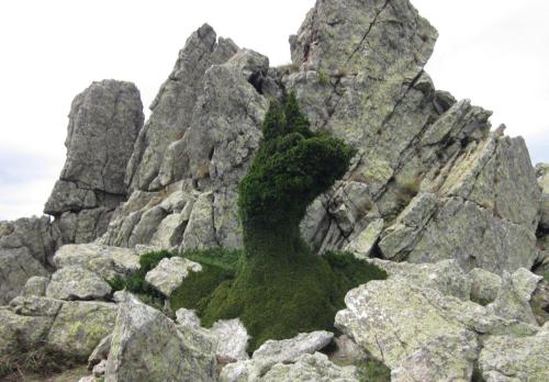
Rather than continuing to walk to the beach I pitched up early (~3:00pm) in the lea of the tor on Pic de Sailfort (GPS 503333/ 4702684). I’d a nice view east across the Med but I did have to carry water from Source Tagnarede and the wind really whipped across the ridge during the night.
Judging by the holly bush nearby, which looked like a topiary specimen, the wind blows a lot.
Day 38 – Friday, 15 August 2014
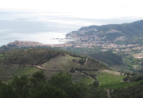
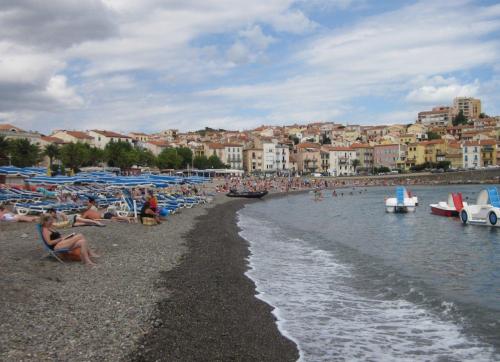
A 2 ½ hr stroll to the finish line in Banyuls.
I came across the Maison Randonee (beach side of the tourist office), the guy there spoke excellent English & was very helpful; useful map of the town available; the tourist office usefully had free high-speed Wi-Fi.
I ended up at the Municipal Campsite, about 15mins from the beach, where I got the last available pitch. Campsite was reasonable though the ground is just compacted shale & the Wifi didn’t work; cafe there produced a good pizza. There’s a large supermarket next to the campsite & plenty of places to eat around the town (though pricey).
Getting home:
The train station in Banyuls is about 20 mins walk from the campsite and ~€7.50 gets you whisked away to Perpignan on a very frequent service, it takes about ½ hr.
Once in Perpignan if you’re headed for the airport, like me, the cheapest option is the #7 bus (€1.20), unfortunately it doesn’t leave from the train station. Head ENE from the station along Ave General de Gaulle for about 600m to a major tee junction, Catalogne square in front of you. Turn left, pass the Casino market (20m) then cross the junction to the Naponi restaurant & follow the street for about 100m & you’ll find the bus stop.
Reflections:
A fantastic trip, one for the memory banks and lot’s of tales for bothy nights filed away. The 35 day duration (excluding days where I deliberately delayed to match my flight date) was probably about right for me. The route is 800 km with 42 km ascent; I didn’t take any ‘rest’ days on route far preferring to have a short day ever 5-7 days as I get very bored hanging around; hence a normal days trek was 25 – 30 km with 1200 – 1500m ascent. The aim was a coast to coast trip & in that it was a success but there’s a lot more to explore; I’d like to do the bits of the HRP where we took variations, I’ll be back.
I ‘lost’ 4kg on the trip; it did take a couple of weeks before the appetite finally caught up with the effort, after that consuming calorie was almost first priority.
My base weight was 7.9kg, a bit heavy, definitely took too much ‘stuff’ but the how…what… why will wait for another post.
We met a variety of people on route from: a couple of Swedes travelling very light (½ full Talon 33 packs; 6mm CFF mats, wafer thin sleeping bags, etc) & planning to complete the HRP in less than 4 weeks; to a French guy just setting out from Banyuls carrying ~30kg, included a large machete & guitar, who reckoned he was going to complete the GR10 in 22 days (my advice was to give it 2 -3 days then post what he didn’t need home). Most of the backpackers were somewhere in the middle, ~18kg loads and big boots.
The weather was often described by the ‘natives’ as the worst they had ever seen; we had the full gambit of mountain weather and more than our fair share of rain. It did sometimes work in our favour though; the dreaded +30C days as the Med is approached never appeared, it was probably around 16 – 18C.
The Cicerone Guide book; a lot of poor translation &/or poor wording led to confusion on numerous occasions, IMO it really needs a rewrite. We weren’t the only ones with these opinions; numerous people on the trail had similar comments. There’s also the opportunity to add an increased number of variations to the guidebook, particularly for occasions where heading to a refuge or town isn’t desired. I generally found the guidebook hours walking on each of the stages to be generous, although those carrying heavier loads may not find it so. The stated ascent on each of the stages is probably understated by 15%; only significant climbs seem to be counted.
Navigation was generally fairly straight forward; if you can backpack in somewhere like Scotland where there are no signposts or paint flashes then you’ll probably not have an issue, unless you can led astray by the guidebook. Maps are a necessity, the guidebook alone is not sufficient (unlike something like the GR10 where we came across people with zero maps) The GPS proved quite useful particularly in Basque country but on the vast majority of days it was unused. The Axio altimeter with a Suunto clipper compass attached was invaluable; keeping the altimeter calibrated was easy thanks to the number of reference points each day (signposts, refuges, etc)
If anyone would like further information/ detail you’re quite welcome to drop me an email.
Note:
In 2016 I completed a traverse of the bits of the HRP I missed out on due to the volume of snow you can view the post at HRP Revisited
I’ve also published straight forward guide HERE with GPX & KML files

Looks terrific. Deeply jealous. My wife would never let me do it.
Just pack the sack & tell her you’re going for a walk
Then I’d get the sack, but in a different way 😉
I have been contemplating a longish trek in the Pyrenees for Summer 2015. Main problem is finding a dog sitter or expensive long kennel stay. But this post is extremely useful and informative. Far more so than any other blog or guide book found to date. Thank you.
Looks like an amazing hike.
The best backpacking I’ve experienced & the vin rouge is pretty good too.
Thanks for sharing Paul very tempting .I have the George Veron guide just wonder if it is better to follow that than the cicerone guide.I have wandered for two weeks from Cauterets over to Torla,Ordesa and Gavarnie for a few years maybe it is time to do this before I get too old as I am 66 now.
Hi Owen, I believe the Vernon & Joosten routes differ for some of the section, all the folk we met on the trail were following the Joosten one. 66 yrs is no impediment per say, fitness is. If you’ve backpacked the Pyrenees for 2 weeks OK I’d say go for it, at your own pace.
Thanks for the encouragement Paul
Great account of your crossing, very similar to our experience in 2013, regular frustration with the guidebook (shared by all who have used it I believe) and similarly difficult resupply and disinterested refuge guardians……loved every step and went back last year to walk sections we had missed out along with some peaks!
Now planning an East West crossing for 2016
Heading back to the Pyrenees in 2015 for ~6 weeks, just planning a bit of a zigzag not a C2C may get the bits of the HRP I missed out if the conditions are right.
Have you done any of the canyons on the Spanish side yet, they are spectacular.
Was planning on taking some of them in this trip, found Kev Renolds books to provide some interesting ideas.
Kev Reynolds guide is excellent in suggesting link ups, if you get the opportunity its worth comparing Rando Edition maps with Editorial Alpina as they don’t always show the same trails. Always bear in mind though the spanish are just as likely to close a trail or turn it into a road!
Look forward to reading of your adventures.
My friend and I leave in august for the HRP! Cannot wait! Any suggestions?
Keep the load light & be cautious when following the Cicerone guide. ENJOY!!!
Currently in the Pyrenees, far too hot 30C+, a lot less snow around than 2014.
Hi Paul,
Thanks for the info, very helpful! So I am planning to do the HRP in early Sept, but could not get three maps recommended by Joosten:
Editorial Alpina map Baztan-Bidasoa
Rando maps 22 and 24
or is it possible perhaps to use Rando 4 instead of 24 and Rando number 6 instead of 22?
Alternatively, am I getting this right that you seem to have only used electronic maps? Can you give a few more details about how you did that? And what about using GPS or iPhone?
Thanks!
Andreas
Currently in Puigcerda, will reply with more details when I get home in about a week.
As noted in the post the maps I used were A4 prints of the 50k maps I downloaded from Centro de Descargas. After downloading I marked the HRP route on the maps using ‘Paint’ (an MS accessory) then copied ~14km * 10km sections for printing on A4. As stated they’re not as ‘good’ as the Rando maps but I found them adequate.
Another resource if you have a Garmin device is the FREE mapping you can download from Topopirineos.blogspot, the HRP route shown doesn’t always correspond to the Joosten route but that shouldn’t be a big deal it’s easy to add your own bits in ‘Basecamp’.
I am planning to do the trip this summer. What maps did you take with you?
The first few paragraphs of the posting ‘Planning‘ gives details.
If you have a Garmin GPS I would also recommend checking out Topo Pirineos, pretty good FREE mapping.
Hi Paul.
I really enjoyed reading your experiences on this adventure.
In July I will be going on my first hike in the HRP from Andorra to Banjuls.
I would like to get an idea of how cold it gets in the evening? We will be wild camping so I want to know what I need to take with me.
Thanks,
Kay
Being east of Andorra you’ll probably will not see temps below 5C & that’ll be below the norm. I use a thin full base layer as PJ’s instead of a sleeping bag liner, so these + day clothes with a micro fleece & perhaps the waterproofs would be fine for me if it’s chilly. I always reckon you can always crawl in the bag if it’s cold.
Hi Paul,
We are planning to do (part of) the HRP in the first 3 weeks of July. Your post is very helpful to get an idea where to resupply, opening hours, and an early warning regarding the quality of the guide. I will receive a new edition of the guide in the coming days, I hope that version will be a bit better.
This will be the first time we will be using our new Trailstar and I read you have used it as well for this trip. What is your recommendation regarding bug protection? Do we need a bug bivy or something like that? Have you used a ground sheet and what would you recommend given the amount of cattle we may encounter?
Kind regards,
Helen
Only had trouble with bugs once on the HRP (near Arinsal) & we could have moved on to a ‘better’ place if needed, so a bug bivi is not really needed. I use one on the GR11 last year to keep drafts off though.
Ground sheets; the ‘needle’ grass in the high country WILL pierce the thin silnylon material, so I’d recommend either a bathtub ground like the Trekkertent from 70D material (too late to order now) OR a simple flat TYVEK ground sheet; Extremtextil have 1073D hard structure which is very tough.
Best advice with the cattle is not to pitch up close to a water source; 100 – 200m away is good. I’d also carry a Sawyer Mini water filter as I’ve found that I end up carrying less water, resupply even at lower elevations always an option.
Thanks for your quick response. Tyvek seems to be a useful solution.
“Day 4 – Saturday, 12 July 2014
A day of wandering the hills in rain & low cloud.
Camped at Egurgui (GPS: 651224/ 4765166), [Stage 5, End], definitely the worst pitch on the trip, a quagmire. The whole valley had been churned up by 100’s of cattle & s**t everywhere! No sign of the “fine & quiet places for a bivouac” mentioned in the guide”
The guidebook states that the “fine & quite place for a bivouac” is at “border stone no 223. GPS 649638/4766301. Cross the stream and follow it”!
You walked over 2klm’s past it to arrive at the cow-shit!
On the day it was as described, everything very soggy after days of rain & cattle all the way down the valley.